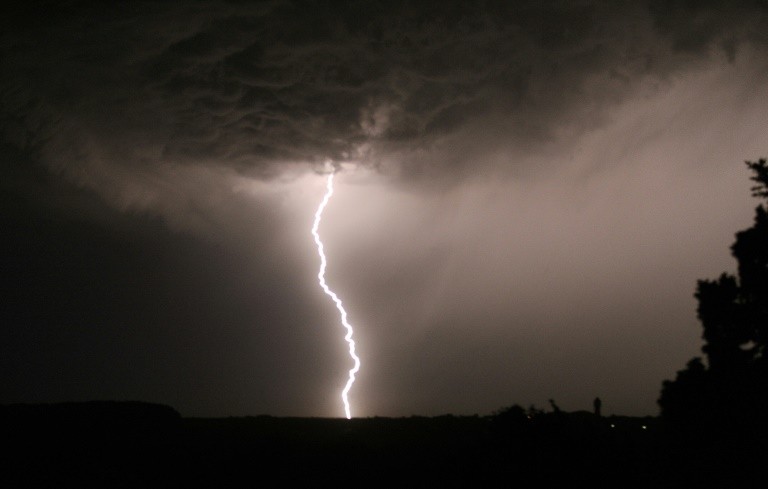
Severe Thunderstorms: 42 Departments on Orange Alert, Record Number of Lightning Strikes in May

This Wednesday, Meteo France has placed 42 departments of Aquitaine to the Grand est on orange alert because of violent thunderstorms expected at the end of the day.
42 departments of Aquitaine, Occitanie, central France and North-East were placed in orange alert for severe storms and thunderstorms. The episode is expected at the end of the day, Wednesday 30th May, said Meteo France in its updated report of 4pm.
The departments of Ardennes, Aube, Cher, Côte-d’Or, Doubs, Indre, Jura, Loir-et-Cher, Loiret, Marne, Haute-Marne Marne, Meurthe-et-Moselle, Meuse, Moselle, Nièvre, Bas-Rhin, Haut-Rhin, Haute-Saône, Saône-et-Loire, Vosges, Yonne and Territoire-de-Belfort, were first concerned.
The orange alert was extended to the South-West, with a beginning of vigilance for Ain, Ariège, Aveyron, Charente, Corrèze, Creuse, Dordogne, Haute-Garonne, Gers, Gironde, Indre-et-Loire, Landes, Lot, Lot-et-Garonne, Pyrénées-Atlantiques, Hautes-Pyrénées, Seine-et-Marne, Tarn, Tarn-et-Garonne and Haute-Vienne.
🔶 42 dpts en #vigilanceOrange
Restez informés sur https://t.co/rJ24zzmmy4 pic.twitter.com/0DqJH4aSGg
— VigiMétéoFrance (@VigiMeteoFrance) May 30, 2018
Record of lightning impacts for a month of May
France had never suffered so many lightning strikes for a month of May since at least 2000: with 41 departments placed in orange alert this Wednesday, the country continues to live to the rhythm of thunderstorms, an electric episode worthy of a month of August.
The soil of France has been hit by 157,000 lightning strikes since the beginning of the month, the unheard of since at least 2000 and the start of censuses set up by Meteo France.
The previous record dates back to May 2009, which was then shaken by 84,000 impacts.
“These storms are not exceptional in their intensity but in the fact that they arrive early: we see rather this type of events usually in the heart of summer,” said forecaster Patrick Galois.
This stormy series has sometimes done heavy damage and even a victim, a 6 year old girl died after the fall of a branch in a park Saturday near Laval.
The Bordeaux vineyard has had 7.100 hectares affected this weekend, or 5% of the land. In Champagne, hail in April and May damaged 1,800 hectares of vineyards, including a thousand entirely destroyed by these phenomena of an “exceptional” precocity according to the Champagne Committee.
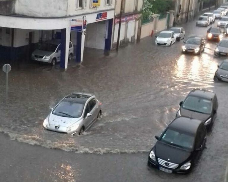
The town of Epinal, in the Vosges, asked for recognition of the state of natural disaster after heavy floods.
Tuesday night, the waterspouts fell, especially in Paris where the RATP had to temporarily close two stations for security. Line 1 traffic has been disrupted by the flooding of a signal cabinet.
After several episodes in recent days, 41 departments on a broadband from South-West to North-East were again placed on alert orange Wednesday, in anticipation of bad weather expected during the afternoon and evening.

It is not finished
The presentation Wednesday of the future security device around the Eiffel Tower was canceled, because of construction site “difficult to pass”.
At the origin of this weather phenomenon: the maintenance on France of a hot and humid air mass, creating “a repetitive situation”.
“The situation has been stable for a few days,” says Patrick Galois. “For active thunderstorms, you need warm air but also contrasts, with warmer air in the lower layers and colder altitude, and humidity”.
No region has so far been spared, with the possible exception of Brittany. “It’s the natural variability of the climate, always exacerbated in the spring,” says the expert.
“And this spring has a peculiarity: the atmosphere is a little rotten, since the warm air is located rather in the north of Europe and the fresh air is diverted towards the South”, he explains, evoking the presence of “an anticyclone screwed on Scandinavia for several weeks”.
Toulouse had a cooler month in May than Oslo, where it was 29 ° C.
Overall, this month of May was rather milder, except near the Pyrenees. Among the few records recorded, Charleville-Mézières (where it was 4 ° C more in the afternoon than Biarritz), and others to wait perhaps for Lille and Saint-Quentin.
Rainfall, no national record, but some local records were recorded: in Villefranche-de-Rouergue (78 mm in 24 hours, record since the opening of the measuring station 30 years ago), or in Calvados .
And it’s not over … After a “lull” Friday and Saturday, a new “cold oceanic drop” Sunday and Monday will reactivate the storms, warns the forecaster, because “we still have this block with the anticyclone” on the North.

Enjoyed this? Get the week’s top France stories
One email every Sunday. Unsubscribe anytime.


