Storm Harry will hit Europe: Flood, Wind, Snow… What Consequences in France this Weekend

The situation in the south of France promises to be worrying between now and Tuesday 20th January 2026, with impressive rainfall accumulations linked to storm Harry. Forecast.
After the downpours that fell on the Finistère this Thursday 15th January, the south of France is on alert for several days, until Tuesday, January 20, 2026. In question? There storm Harry, appointed this Friday 16th January 2026 by Aemet, the meteorological agency in Spain.
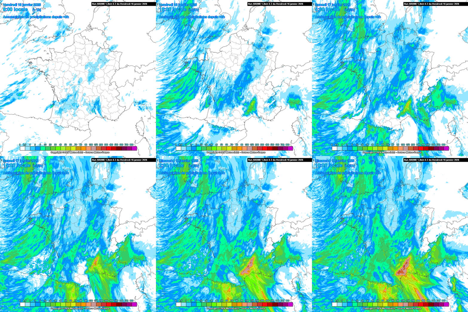
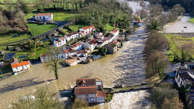
Consequence? “A high risk of flooding and floods taking shape in the south-east of France, including Corsica, from this weekend of Saturday 17th January and Sunday 18th January”, warns meteorologist Yann Amice.
In the north of the country, these next few days will be marked by the return of morning frosts, before another hypothetical return of one cold livelier at the end of the month and very beginning of February, as we explain in this article.
Cumulative rainfall of more than 300 millimeters, one meter of snow
By this Tuesday, cumulative rainfall of more than 300 millimeters are already anticipated by the models weather, and even more than a meter of snow in the Pyrenees at around 1,400 meters above sea level!
The meteorologist targets the cities of Carcassonne and Narbonne (Aude), Perpignan (Pyrénées-Orientales), Béziers (Hérault), Corsica, but also the departments of Gard and Lozère.

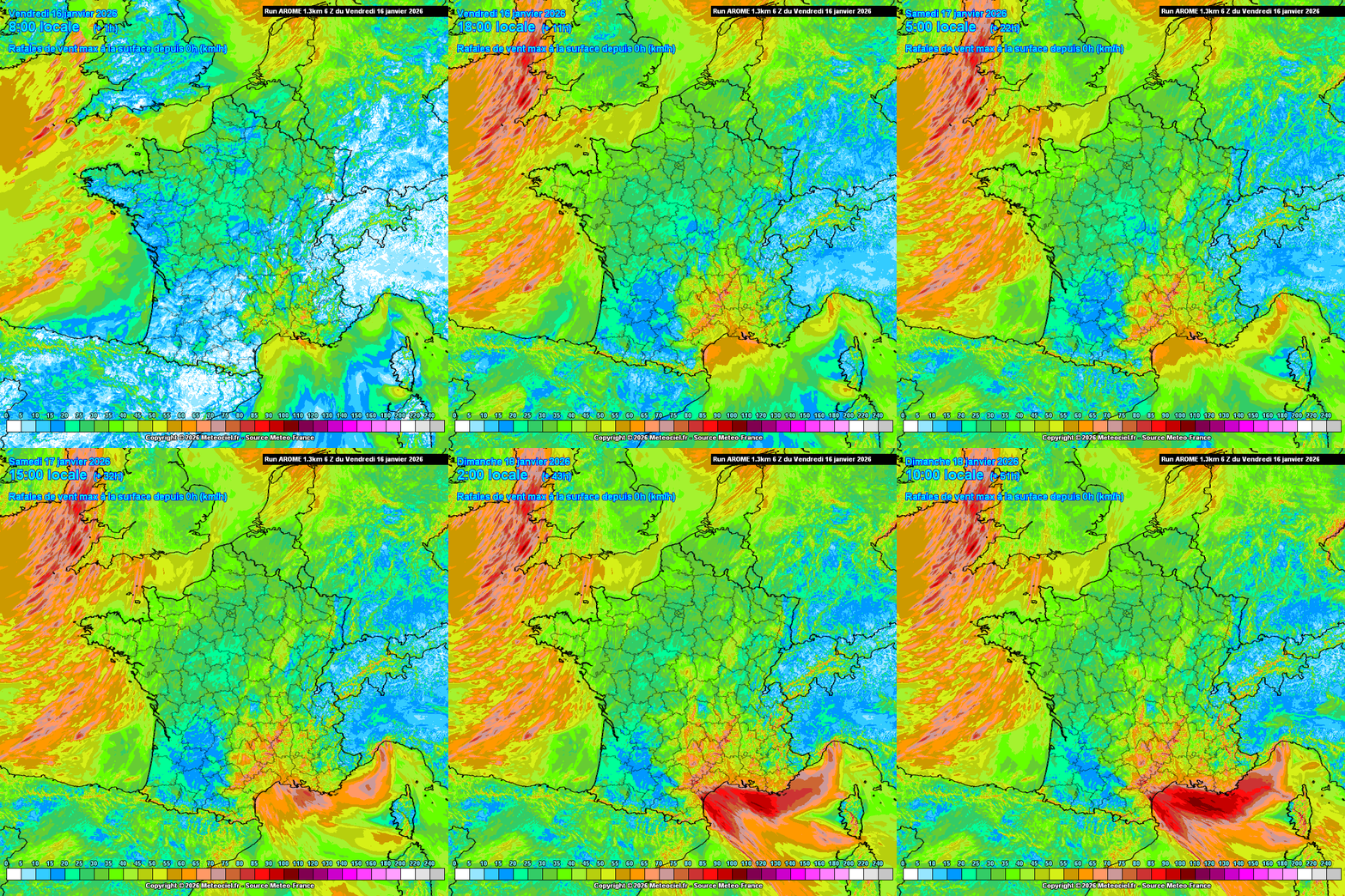
In connection with this storm, a Mediterranean episode will take place this Friday, January 16 with sustained rain on the Cévennes terrain and in the plains, from Hérault to Bouches-du-Rhône and Var, with, in bonus, strong wind on the coasts at sometimes more than 100 km/h.
At the origin of this flood in the south of France, a depression called Harry which will shift between the Balearic Islands and Algeria this weekend of Saturday January 17 and Sunday January 18, to park there, and which will rise over the country, to the south, a very humid southeast flow. On the menu: heavy rain, very heavy snow above around 1400 m in the Pyrenees, but also strong wind on the Mediterranean coasts.
It is in reality an axis of low pressure, also sometimes called “barometric trough”, which will be put in place from Algeria and Libya and bring up this air (very) loaded with humidity for several days.
“With cold air at altitude and the blocking of high pressures further east, this depression will tend to remain there, hence these risks of flooding and flooding with significant and above all lasting rain”, insists Yann Amice.
In Spain, weather services are warning of these upcoming bad weather conditions which could damage seafront promenades and coastal areas, and lead to falling branches, trees and fragile or poorly maintained architectural elements, and of these rains likely to cause local floods and floods.

A refreshment from the northeast at the same time
The other consequence of this very southern low pressure axis on the Mediterranean will be to bring a slight continental influence on the rest of France, and thus a refreshment from the northeast, with the return of morning frosts and temperatures which should not exceed 10 °C during the day from next week, after the mildness of the last few days.
A slow and gradual drop in temperatures, but no cold snap, but simply a return to values close to seasonal norms, or even slightly lower, in the moment, next week.
During the year 2025, every other day recorded a temperature above the seasonal normal, compared to only one day in five below normal, a sign if necessary of the rapid evolution of our climate. This is one of the conclusions of the climate report for the year 2025 published this Thursday 15th January by Météo-France.
The year 2025 ranked 4th among the hottest years ever recorded in France since measurements began in 1900, behind the years 2022 and 2023 and 2020, ahead of 2024.
Enjoyed this? Get the week’s top France stories
One email every Sunday. Unsubscribe anytime.


