Weather: Beware the Cold is Back, Frost and Snow Expected

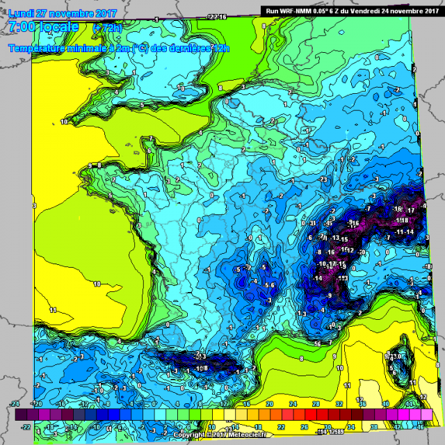
Lower temperatures began as early as Sunday. It will continue this week. Frosts will gain ground. The first flakes of snow appear on the mountains. Be careful on the roads, they may be icy in the morning.
The week looks cooler. Nothing unusual at this time of the year. Just like this Sunday 26th November, the weather will be marked by falling temperatures and variable sky, split between cloudy, cloudy, according to Meteo France.
Grand East Massif Central and Rhone Alps and the Pyrenees, the clouds will be numerous and compact. They are sometimes accompanied by rain with some snow on the mountains of the Vosges, the Jura, north of the Alps, the Massif Central and the Pyrenees from 500 m. Locally flakes will be as low as possible, in Champagne or Burgundy.
On the north-west and the north, some coastal showers will signal if under moderate wind from northwest. These showers, fairly dispersed, will spread during the day between the north and center of the country.
Overcast in the West

However, the sky will cover the West. The clouds become denser during the day to give a few rain showers or a few, on the northern Brittany.
On the southwest after some grisaille morning, the sky alternate cloudiness and thunderstorms. Clouds will become more numerous in the late afternoon on Aquitaine. During the afternoon, the clouds will return to the Pyrenees.
In the Southeast, Mistral and Tramontana emerge heaven. But they will blow strong, reaching 80 km/h in Languedoc-Roussillon and Rhone Valley, 90 to 100 km/h in lower Rhone valley, on the capes of Roussillon, on the Var coast, on the relief of the Southern Alps and Corsica, the north and south of Corsica. On the east of Corsica, clouds and a few showers will be well represented with snow above 1,000 m altitude.
The temperatures will be lower and will see the return of low morning frosts inland. The maximum will not exceed 3 to 8 degrees East Grand Massif Central and Rhone Alps, reaching only 7 to 12 degrees elsewhere, locally 13 to 15 degrees in the French Riviera and Corsica.
Enjoyed this? Get the week’s top France stories
One email every Sunday. Unsubscribe anytime.


