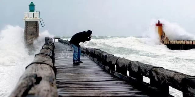
Storm Benjamin: Gusts up to 130 km/h, Strong Waves, Disrupted SNCF Traffic… What to Expect on Thursday in New Aquitaine?

WEATHER: Storm Benjamin, the first storm of the Autumn, will sweep across France from Wednesday evening. Seven departments are on orange alert for Thursday, including four in New Aquitaine
Violent gusts, strong waves, significant accumulations of precipitation… France is preparing to face its first autumn storm, Benjamin. It promises to be strong and will sweep away a large part of the territory, and more particularly the coastal departments of Nouvelle-Aquitaine and Manche.
Four departments of Nouvelle-Aquitaine on alert
Storm “Benjamin” will “deepen” at the entrance to the Channel on Wednesday evening, even if “there is still uncertainty about its trajectory and its digging, and therefore about the wind and the accumulation of precipitation associated with this depression”, according to Météo-France.
For now, seven departments are on orange alert for Thursday, including four in New Aquitaine: Charente-Maritime for violent winds and Gironde, Landes and Pyrénées-Atlantiques for both violent winds and flooding from wave-submersion. This alert will probably be extended by the end of the day.
Gusts up to 130 km/h Thursday morning
The first effects of the storm should be felt on Wednesday evening, when the west wind, already strong all day, will begin to strengthen on the Atlantic coast and in Brittany, with gusts already at 90 to 100 km/h. h along the coasts.
But it is especially at the end of the night and early Thursday morning that the wind promises to be violent, “particularly on the Atlantic coast and the Channel coasts”, according to Météo-France. Gusts of 100 to 120 km/h, or even locally 130 km/h, are forecast on the coast, and 90 to 110 km/h inland. Knowing that at the end of October, the trees have not yet completely lost their leaves, they are therefore more vulnerable to gusts, which can tear them off or cause their branches to fall.
“Weather bomb”
The storm, which was around 1,000 hectopascals (hPa) at midnight on Wednesday and will be around 970 hPa on Thursday at midnight, according to Thibault Corouge, forecaster at Météo-France, perhaps considered a “weather bomb”.
The phenomenon itself is quite classic. It is due to the encounter of cold air with a warmer air mass, causing a significant drop in atmospheric pressure. More precisely, we speak of a “weather bomb” when the pressure drops by more than 20 hPa in 24 hours. Which was for example the case of the storm of 1999, Xynthia in 2010 or even Ciaran in 2023, the digging of which had been significantly more “explosive” than that of Benjamin since it had lost nearly 30 hPa in 12 hours.
Strong waves and risk of flooding
Direct consequence: a sharp drop in pressure causes ocean levels to rise. When atmospheric pressure is low, the air column presses less hard on the water column. Ocean level thus gains one centimeter on average for each hectopascal lost. The normal atmospheric pressure being 1,013 hectopascals, a depression at 970 hPa, like Benjamin, can inflate the “normal” tide by around forty centimeters.
Of course, we are not in a context of high tides, but the coefficients are still relatively high and this mechanical rise in sea level, coupled with gusts and strong waves, leads to a risk of flooding on Thursday. It will be more marked at high water, namely at 6 a.m. from La Rochelle to Saint-Jean-de-Luz, where the coefficient will be 83, then between 6:10 p.m. and 6:15 p.m. (coeff 81).
SNCF traffic disrupted
The SNCF has already warned: “Deletions and delays are expected on all TER lines in Nouvelle-Aquitaine”.
🚨 #AlerteMétéo
Ce jeudi 23/10, des vents forts risquent de souffler sur une grande partie de notre région #NouvelleAquitaine.🔴Des suppressions et des retards sont à prévoir sur l’ensemble des lignes #TERNA.
Nous vous recommandons de reporter votre voyage.#Soyezvigilants pic.twitter.com/4bajj5MaN6— SNCF Voyageurs TER NOUVELLE-AQUITAINE (@TERNouvelleAQ) October 21, 2025
Enjoyed this? Get the week’s top France stories
One email every Sunday. Unsubscribe anytime.


