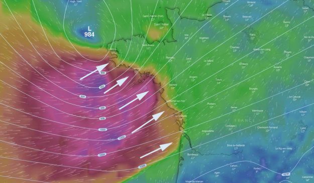
Weather: Strong Winds from the West this Afternoon to Thursday Morning

A weather disturbance, coming from off the Atlantic, this Wednesday at the end of the day in the immediate vicinity of Brittany, before continuing its way towards the North-East. Strong wind, sustained rains and gusts to 100 km/h will thus concern the west of the country, from Finistere South to the Gironde, until Thursday.
It will blow! From the Breton tip to the mouth of the Gironde, between Wednesday end of the day and Thursday morning, the west side will suffer the onslaught of a southwest wind of 35 to 45 knots (60 to 80 km/h) , with gusts with more than 100 km/h.
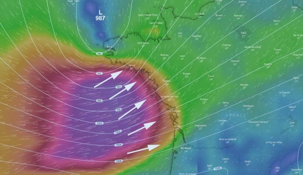
Here are two more days, the weather models were not really in agreement on the trajectory and the intensity of this gust of wind. Just shy of 36 hours into the disruption, the GFS (Global Forecast System) and European ECMWF (European Center for Medium-Range Weather Forecast) have aligned their forecasts.
Avis de coup de #vent : une dépression très creuse tangentera ou traversera la France entre mercredi soir et jeudi. Deux scénarios à cette heure sont envisagés. pic.twitter.com/6OUTNCkM7m
— La Chaîne Météo (@lachainemeteo) May 6, 2019
Which show that a fairly hollow low center (from 984 to 987 hPa), coming from the near Atlantic, will reach the Brest area (see map at the beginning of the article) before classically winning to the North-East, culminating successively over the Channel and the North Sea.
⚠️La trajectoire de la dépression apportant un coup de #vent dans la nuit de mercredi à jeudi s’est affinée ! 🌬️ pic.twitter.com/bIkYa1fQLq
— La Chaîne Météo (@lachainemeteo) May 7, 2019
Gusts over 100 km/h
Result: from 4pm, Wednesday 8th May, the breeze south-southwest will intensify, first on Finistere South, then Morbihan. As the depression progresses to the east, the wind – established at about forty knots – will affect the Loire-Atlantique , Vendée ,Charente-Maritime and the Gironde.


Gusts, which may locally exceed 100 km/h along the coast on exposed headlands, will decrease somewhat as the disturbance moves inland. It is expected from 70 to 90 km/h on a broad central band from the Pays de la Loire and New Aquitaine to the Center-Val de Loire to the Grand Est region.
On the tide side, we will be at the end of high waters (coef 81 and 77), which should limit somewhat the risk of submersion waves. That said, a marked swell should break on the Vendée coastline.
Sustained and sometimes stormy rains
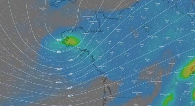
Note that this disturbance will bring a restless and rainy weather from Wednesday morning early, with sometimes stormy showers in the day and the following night (map below). The accumulations over the period will be of the order of 20 to 25 mm, up to 50 to 60 mm on the Alps with a rain-snow limit to 2,500 meters of altitude..

The restless weather will continue until Saturday, several low vacuum, fortunately little marked, remaining marauding north and west of France. Before the return of the anticyclone next weekend, and that of a nice cool weather.
Enjoyed this? Get the week’s top France stories
One email every Sunday. Unsubscribe anytime.


