Weather: A Vast Episode of Cold Weather in France on Tuesday, with Snow

WEATHER: A change of the weather is expected across France from Monday, lower temperatures and some snow expected as well
As expected, an anticyclone reigns supreme over France for three days. Good weather too with mild temperatures. Morning fogs sometimes very stubborn. And, as announced a few days ago, the cold will take over at the beginning of the week. A season time will you say. You will be right. But still in contrast with the temperatures of recent days. Put a little wool, we’ll see that more closely.
You were told on Monday that the high pressure dome of our country protects us from Atlantic depressions. The good weather is there, sometimes sadly masked by mists fans of the morning, only getting up in the afternoon. Gentleness, fortunately, mitigates this little disappointment.
That said, as announced earlier this week, the cold will soon take over. From Sunday, and especially on Monday, the thermometers will begin to descend from red to blue, touching the zero.
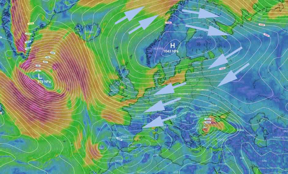
The reason ? Always our anticyclone. That is well raised in latitude, going to put its center and its pressures to more than 1040 hPa on Sweden. Result? Look at the map below: the winds rise to the north, tangent the polar circle, down to Russia and tumble down, bringing a little kiss that has nothing friendly.

That said, if we consider the monster depressions that are born in the immediate east of the US coast and are blocked by high pressure, we say that this cold – seasonal – is not that terrible.
In season, yes. We are going towards winter, we must remember. But it is true that the late season will have provided us with an unusual sweetness and drought. The contrast is clear.
But that’s not all: the rise of the anticyclone towards the northern latitudes opens a few doors to the marauding depressions on the Mediterranean. This will be the case from Monday to Wednesday at least.
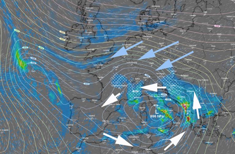
Consider the map below: Tuesday morning, the low center located between Sardinia and Italy will propel the east of France a wet wind that will induce snowfall on the reliefs. Passing the summits, the clouds, numerous, will be able to deliver some flakes to the plain – the West should be spared.

The effect of these low-pressure flows (white arrows, above) will be further reinforced, fed by the east-north-east winds that will continue to flow from Russia (sky blue arrows).
And then ? Well, the medium-term models indicate that the winter man could launch a real offensive at the end of November-beginning of December. It will be verified in due course. But it seems that the jackets will soon take the air.
I would keep an eye on the end of the month/beginning of December for the potential of another major cold blast from Old Man Winter as well as more chances for accumulating snow. #ILwx pic.twitter.com/X6f8J3An78
— Wx Geek (@Wx_Geek) 15 November 2018
That said, do not complain. New York has just experienced its first snowfall of the season (15 cm). And his first mess in the streets:
❄ De l’autre côté de l’Atlantique, New York subit un important épisode neigeux qui a causé la pagaille sur le réseau routier ! (https://t.co/ORk4k6WYZa) pic.twitter.com/hjqbZDbCRR
— Météo Express (@MeteoExpress) 16 November 2018
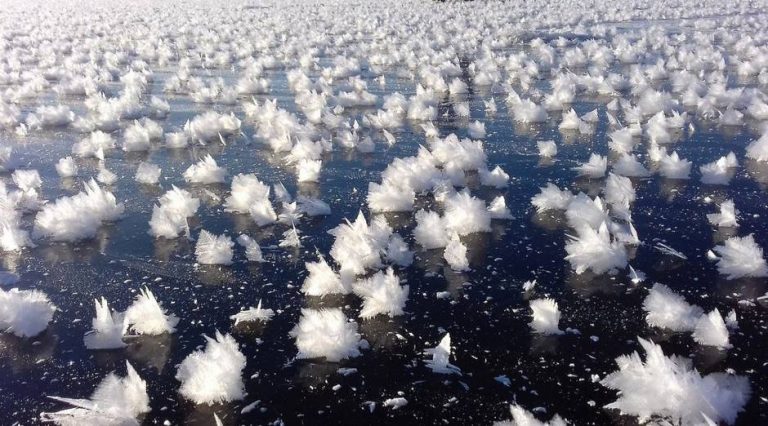
More poetic, ice flowers have appeared in Russia, on a lake not far from Chelyabinsk:

Enjoyed this? Get the week’s top France stories
One email every Sunday. Unsubscribe anytime.


