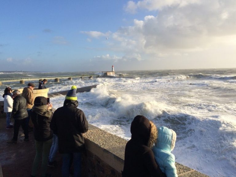
Weather: Storm Eleanor, 48 Departments Placed on Orange Alert

After the passage of the storm Carmen on the 1st January 2018, a new gust of wind is expected in the night from Tuesday to Wednesday. 48 departments were placed on orange alert.
After the visit to France of the Carmen storm on Monday 1st January 2018, New gales, from storm Eleanor are expected until the weekend. 48 departments, from Brittany to North, through the Normandy and the Paris region , are placed in orange alert for wind and waves, flooding, two for flooding.
These strong gales are expected to start in the night from Tuesday to Wednesday, and ended the next day at midnight.
MAJ ⚠️ 48 départements en #VigilanceOrange #VentViolent #VaguesSubmersion #Inondation
Soyez prudents et restez informés ▶ https://t.co/bbNAHFUEZc & @VigiMeteoFrance #Tempête #Eleanor pic.twitter.com/mvMQb6jTwO— Météo-France (@meteofrance) 2 January 2018
Orange alert in 48 departments
After Carmen, Bruno and Ana , this new depression coming straight from the North Sea, the fourth in a few weeks, is called Eleanor , according to Météo France . The storm will be “an unusually strong mountain and Corsican”
Relevant departments:
- Normandy : Calvados, Eure, Manche, Orne, Seine-Maritime
- Hauts-de-France : Aisne, Nord, Oise, Pas-de-Calais, Somme
- Brittany Finistère, Côtes d’Armor, Ille-et-Vilaine
- Center Val de Loir : Eure-et-Loir, Loiret
- Île-de-France : Paris and suburbs (75-92-93-94), Seine-et-Marne, Yvelines, Essonne, Val d’Oise
- Grand Est : Ardennes, Aube, Marne, Haute-Marne, Meurthe-et-Moselle, Meuse, Moselle, Bas-Rhin, Haut-Rhin, Vosges
- Corse : Corse-du-Sud, Corsica
- Bourgogne-Franche-Comté Côte-d’Or, Nièvre, Jura, Haute-Saône, Saône-et-Loire, Yonne, Territoire de Belfort, Doubs
- Auvergne-Rhône-Alpes : Isere, Savoie, Haute-Savoie
Two departments are placed in orange flood alert. This is the Charente-Maritime and Gironde.
Gusts of 110-120 km/h on the coast
The wind is expected to strengthen “quickly” on the night of Tuesday to Wednesday, “from the Channel coast in the second half of night and of Normandy to the northeast of the country on Wednesday morning.” Wind gusts of 110 to 120 km/h are expected on the coast, and the wind should blow from 100 to 110 km/h on land. In the mountains, the same index: gusts near 100 km / h at medium altitudes ( ski resorts ) and 120 to 180 km/h at higher altitudes.
The peak intensity is expected in Corsican with expected gusts of 180 to 200 km / h on the Corsica Cape and Cape Sagro . Wind gusts of 120 to 150 km / h concern the Bastia area.
These winds will be accompanied by heavy rain, which will diminish in the afternoon. Given the strong tidal coefficient , the submersives waves should reach the coast of the areas, causing some flooding. The wind eases off in the afternoon.
During the passage of the storm Carmen on Monday, 40 departments were placed on orange alert. Strong winds caused Sunday, December 31 death of a man in the Pyrénées-Atlantiques , killed by a falling tree in his car near Saint-Jean-Pied-de- Port .
Enjoyed this? Get the week’s top France stories
One email every Sunday. Unsubscribe anytime.


