Weather: Flood Risks in Brittany and the Southwest, Update on the Situation

Monday afternoon, the start of a new disturbance is expected in the west of France. Accumulating rain could well cause rivers to overflow.
Last week was rainy, and the week ahead will be… rainy. After the storm Ingrid and this weekend’s stormy disturbance, a new consecutive disruption is brewing. It brings with it rains which could worsen flood alerts in the west.
Rain in the west from this Monday 26th January
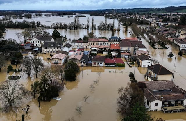
Indeed, after significant accumulations of precipitation, three departments are on orange alert or rain-flood alert (Ille-et-Vilaine, Morbihan and Finistère) in particular the territories crossed by the Oust. This is particularly the case for Redon, which suffered significant overflows and damage during the same period in 2025. On site, the crisis plan is already activated.
But the upcoming rains are causing concern and leading to other departments being placed on flood alert, particularly in the southwest. The departments of Côtes-d’Armor, Landes and Pyrénées-Atlantiques are also on rain-flood alert.
Here is the list of all departments on alert:
- Alpes-de-Haute-Provence avalanches
- Hautes-alpes avalanches
- Alpes-maritimes avalanches
- Ariège : snow-ice, avalanches
- Aude : floods
- Charente : floods
- Charente-maritime : floods
- South Corsica : snow-ice, avalanches, waves-submersion
- Upper Corsica : snow-ice, avalanches
- Côtes d’Armor : wind, rain-flood, floods
- Finistère : wind, storms
- Haute-garonne : snow-ice, avalanches, floods
- Gers : floods
- Gironde : waves-submersion
- Hérault : floods
- Ille-et-Vilaine : rain-flood
- Isère avalanches
- Landes : floods, waves-submersion
- Loire-atlantique : rain-flood, floods
- Lot-et-Garonne : floods
- Sleeve wind
- Morbihan wind
- Pyrénées-atlantiques : avalanches, floods, waves-submersion
- Hautes-pyrénées : avalanches, floods
- Pyrénées-orientales : snow-ice, avalanches
- Savoy avalanches
- Haute-savoie avalanches
- Tarn-et-Garonne : floods
This Monday morning, a new disturbance approaches the Atlantic coast, and ” showers linger south of the Garonne and particularly near the Pyrenees”, while in the afternoon, “a new rainy deterioration approaches the country via Brittany “, announce the Météo France forecasts.
Chain disruptions until the beginning of February?
If certain parts of France should benefit from a short lull, precipitation will resume with a vengeance almost everywhere, Tuesday 27th January, with the arrival of a new disturbance.
And subsequently, “the weather forecast promises to be disrupted at least until the end of January, or even the beginning of February”, according to meteorologist Yann Amice. A possible storm is expected from Thursday.
These rains, sometimes sustained over several days, contribute to increasing accumulations on soils that are already heavily used.
We need to monitor stream levels closely. For the massifs, it will be the accumulations of snow which could be very significant.
Enjoyed this? Get the week’s top France stories
One email every Sunday. Unsubscribe anytime.


