New Storm this Week? “A Cyclogenesis Signal” Which Will Bring Wind, Rain and Snow to France

After Storm Harry, which caused an episode of very heavy rain in the Mediterranean basin, weather forecasters are worried about a train of depressions to come. Here is the Forecast.
The heavy rains and the wind on the threshold of the storm are not over in France. A deep depression should settle near Brittany between Thursday 22nd January and Friday 23rd January 2026. It should still generate significant bad weather, according to the weather models by this deadline.
And a first windy and rainy depression is expected from the west from this Wednesday 21st, January. Before a second, therefore, even more hollow, between Thursday 22nd January and Friday 23rd January.
Harry’s depression currently
Since Friday and until Tuesday 20th January 2026, it’s a depression named Harry by the weather services in Spain which strongly stirs the weather in the south-east of France.
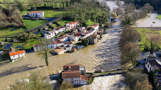
Consequence of these downpours: preventive evacuations in two districts of Narbonne (Aude) and the rescue of a motorist, in the Hérault department, who had taken a flooded road and had to take refuge on the roof of his car following the rising waters. And the rest of the weather program for the week still forecast rain and strong wind.
“A strengthening of the wind is expected on Thursday evening”
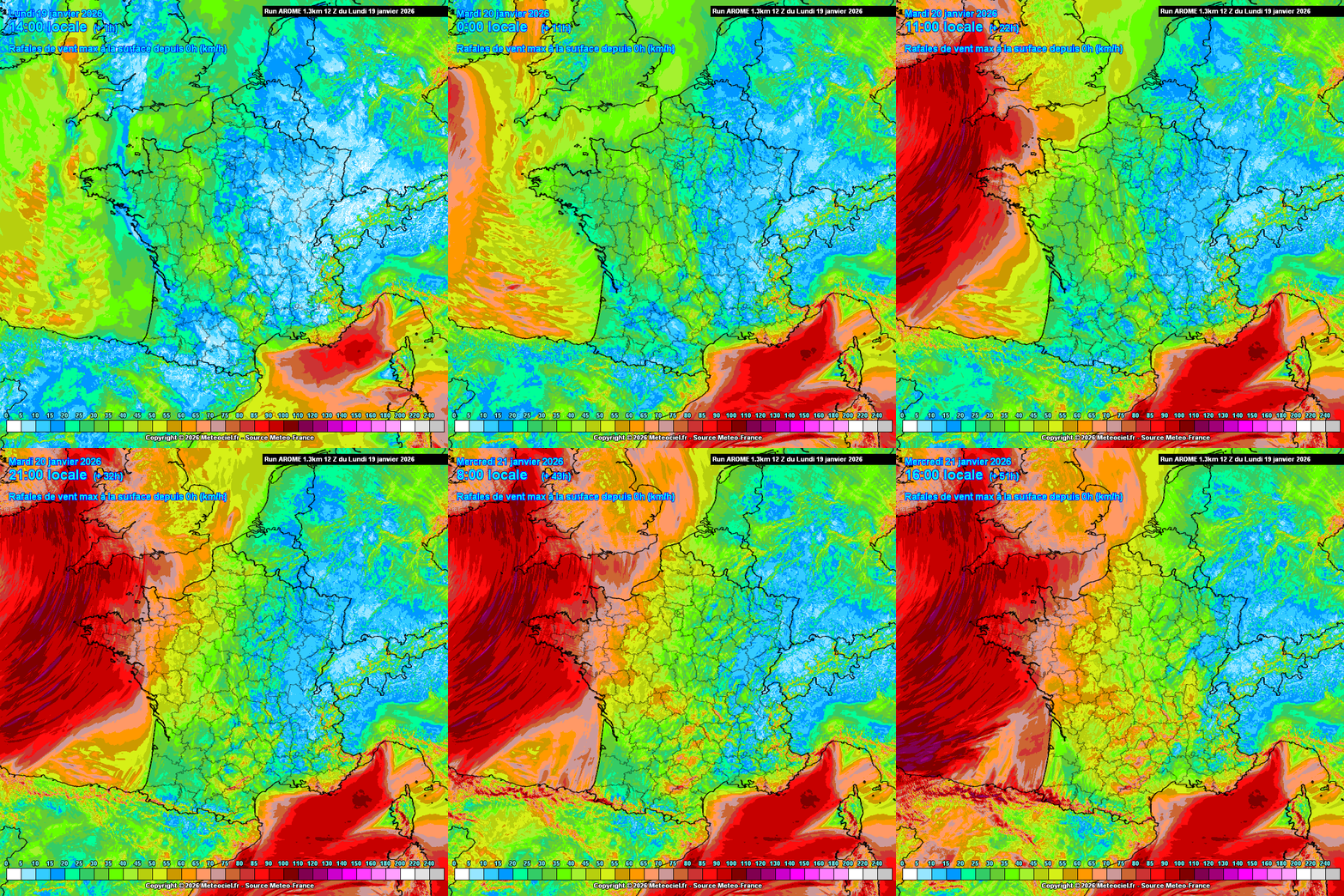
The rains will decline this Tuesday 20th January in the south-east of the country, but a new disturbance, the first in a series, will at the same time arrive from the north-west of France, and stagnate in Brittany, giving moderate rain in southern Brittany, accompanied by a strengthening of the south wind with gusts between 80 and 90 km/h, even 100 km/h on the Breton coast this Tuesday, according to the meteorologist Yann Amice.
On Wednesday 21st January, a new rainy and windy disturbance will affect a large western half of the country, bringing fairly significant accumulations to Brittany. Thursday 22nd January, the rains will mainly affect the south-eastern quarter of the country. It could snow quite heavily at relatively low altitude in the south of the Massif Central. And further rain associated with increased wind is expected on Thursday evening from the Atlantic coast, alongside a risk of strong coastal waves. Strong wind is expected on Friday 23rd January in Brittany, even the Pays de Loire and Normandy.
A depression which will reactivate the rain in the south-east in the middle of the week. And that’s it weekend which is particularly under surveillance meteorologists with the arrival of another depression. Much deeper this time, she could, afterwards Goretti, be named storm Ingrid by the weather services.

France will be located this week between two influences: one, oceanic, which will maintain humid and windy weather in the west, well exposed to a rail of depressions, and the other, more continental, which will bring drier weather in the east.
Falling temperatures but no cold snap
Near the Mediterranean, after the bad weather of recent days and an improvement this Tuesday 20th January, a new deterioration has therefore already been announced for this Wednesday 21st January and Thursday 22nd January, while a storm will threaten the north-west of France at the same time. Busy week, we tell you.

A cyclogenesis signal, a depression which will widen very quickly and very deeply (values between 951 and 964 hectopascals) off the coast of Brittany from Thursday January 22, 2026 is present on many weather models. A pattern which seems to outline a very strong risk of stormy winds between Thursday and Friday January 23, remains to be precisely refined the trajectory of this low pressure minimum.
Temperatures, beyond a disrupted weekend, will gradually drop. “But no cold snap in sight, just a return to seasonal values”, insists Yann Amice.
Enjoyed this? Get the week’s top France stories
One email every Sunday. Unsubscribe anytime.


