Snow will Fall in the Pyrenees: up to 70 cm of Powder in Some Places

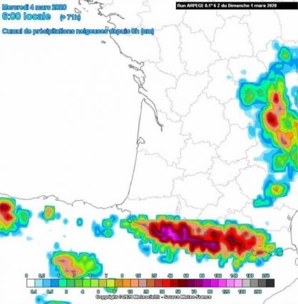
From Monday 2nd March 2020, snow will fall in abundance in the Pyrenees. It will last until Wednesday. Up to 70 cm of snow could fall
From this Monday, March 2, 2020, Occitania will be faced with a beautiful disturbance which will bring strong winds. Gusts could indeed reach 110 km/h in the south of the Toulouse region.
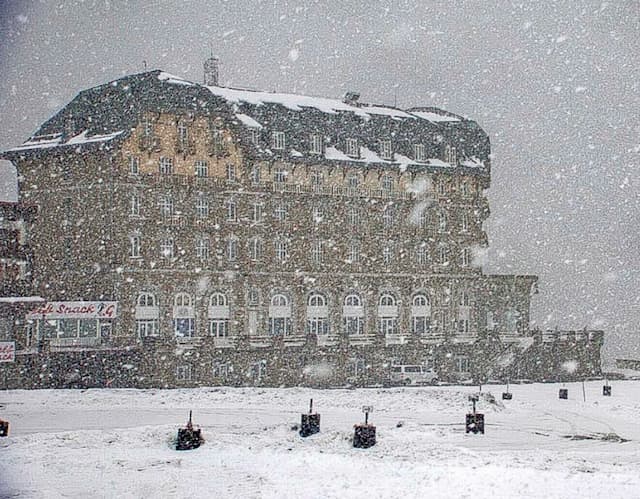
Besides the wind, the rain will fall steadily on the plain. Rain that will turn into snow in the Pyrenees. From Saturday, the snow started to fall on certain parts of the chain, especially in Andorra :
PAS DE LA CASA 2513m -1 📷 @MeteoAnd_OECC @Meteo_Pyrenees #andorra #pyrenees vent >100km/h ouest/nord ouest pic.twitter.com/wzO85JoCJ1
— Météo Pyrénées (@Meteo_Pyrenees) February 29, 2020
☃️☃️ BONES NOTÍCIES ☃️☃️
❄️❄️ Neva intensament a @OrdinoArcalis ❄️❄️#meteo @4estacions2 @lugaresdenieve @Meteo_Pyrenees @MeteoPiri @AndorraLovers @alexmegapc pic.twitter.com/YwJAcqOG55
— Visual Meteo (@VisualMeteo) March 1, 2020
It will intensify in the night from Sunday to Monday.
20 to 50 cm of snow Monday
“The most active disturbed passage is, in fact, announced for this night from Sunday to Monday and for Monday morning, which implies the strongest accumulations in these sectors and the border ridges, notably on the side of Gavarnie. The accumulations are significantly lower as soon as one crosses the Pyrenean barrier, indicates Météo Pyrénées to Actu Toulouse. “
D’ici demain soir, la dégradation qui débute ce soir par l’ouest et qui va gagner l’ensemble des #pyrenees devrait apporter jusqu’à 50cm de #neige sur l’#aragon secteur Monte Perdido notamment, 20/30 ailleurs (Ouest et sud ou #andorra )
>1800m puis lpn en chute pic.twitter.com/bVRS7ogfCm— Météo Pyrénées (@Meteo_Pyrenees) March 1, 2020
Tuesday another disruption
On Tuesday, another disturbance could bring new snowfall. If it is difficult to estimate the expected snowfall, it could fall from 25 to 40 centimetres above 1700 meters and up to 70 cm on the border ridges and the west of the chain, according to Météo Pyrénées.
By Wednesday: up to one meter of cumulative snow
If the forecasts are confirmed and the warmth is not too strong, by Wednesday, it is, at most a meter of accumulated snow, which could fall on certain parts of the Pyrenees. Quite small areas. The Hautes-Pyrénées would be mainly concerned.
On the rest of the western part of the chain, especially in Haute-Garonne, the accumulations would also be very interesting with 60 centimetres of snow.
Snow will also be present in the foothills of the Tarn and Aveyron. But it should only be around a few inches.

Something to bring a smile to the ski stations
As the “official” spring is looming and the ski season is entering its final stretch, these snowfalls could give a smile to the resorts that are still open, they who maintain their slopes as best they can despite the very unfavourable conditions.
Whatever the final cumulative height, this snow will not hurt, as evidenced by this image from the webcam of Agudes (Peyragudes) Sunday 1st March:

Enjoyed this? Get the week’s top France stories
One email every Sunday. Unsubscribe anytime.


