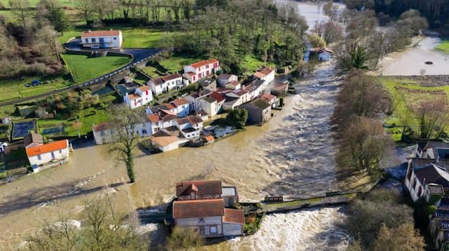
Storm Goretti: Météo France Triggers Red Alert for Exceptional Winds

Wind gusts of 160 km/h are expected in Normandy between this Thursday 8th January and this Friday 9th January 2026. Forecasts and explanations.
The first storm of the year 2026, named Goretti by Météo France, promises to be severe. In its 6 a.m. bulletin this Thursday 8th January 2026, the institution Météo-France has triggered a red alert for the Manche department. This is the highest level of vigilance.
Pour jeudi 08 janvier 2026 :
🔴 1 département en Vigilance rouge
🟠 27 départements en Vigilance orangePour vendredi 09 janvier 2026 :
🔴 1 département en Vigilance rouge
🟠 29 départements en Vigilance orangeRestez prudents et informés :https://t.co/JGz4rTUvHP pic.twitter.com/XZQWwopyWm
— VigiMétéoFrance (@VigiMeteoFrance) January 8, 2026
This red alert could concern other departments during the day, storm Goretti having to be accompanied by “very strong gusts of wind over a large northern half of the country, even violent on the Channel coast.
What does red alert involve?
A red alert is triggered when “weather phenomena” dangerous of exceptional intensity are planned, with several consequences to take into account.
Besides difficulties on the road, the rail network, airspace and at sea, Météo France warns that “very significant damage may affect distribution networks electricity and telephone for several days.
Power and telephone outages can affect distribution networks for very long periods of time. Numerous and significant damage is expected to homes, parks and plantations. Forest areas can be strongly affected.
Also pay attention to strong waves caused by the storm: “around estuaries during high tide”, floods are possible.
Behavioral advice to adopt in the event of red alert?
- I close doors, windows, and shutters
- I don’t use my car
- I stay at home
- I will keep myself informed with the authorities
27 departments in orange
In addition to red vigilance, many departments are affected by vigilance orange “wind” due to storm Goretti, for Thursday.
The departments concerned:
- Calvados
- Charente-maritime
- Côtes-d’Armor
- Eure
- Eure-et-loir
- Finistère
- Ille-et-Vilaine
- Loire-atlantique
- Maine-et-Loire
- Mayenne
- Morbihan
- Orne
- Sarthe
- Paris
- Seine-maritime
- Seine-et-marne
- Yvelines
- Deux-sèvres
- Vendée
- Essonne
- Hauts-de-Seine
- Seine-saint-denis
- Val-de-marne
- Val-d’oise
Storm Gorreti, described as “weather bomb”, as we explain in this article, will circulate in the Channel between this Thursday January 8 evening and this Friday January 9, 2026 morning.
Violent gusts of wind are expected in the departments of Manche, therefore, but also in Calvados and Seine-Maritime who could also go into red alert during the day.
Also read: Storm Goretti: Powerful Atlantic Storm and “Weather Bomb” Threaten Northern France
In the Manche department, wind gusts are expected to reach 150 to 160 km/h on the coast and 130 to 140 km/h inland. In departments on orange alert, the expected gusts are of the order of 100 to 120 km/h inland, and up to 130/140 km/h on the coast.
Concerning the Paris region, the expected gusts are of the order of 90 to 100 km/h for an episode which promises to be lasting, “these gusts could occur for several hours”, warns Météo France.
Furthermore, this storm will generate strong waves west. These waves could increase in the evening, requiring increased vigilance towards orange for the western Channel departments for the open sea on Thursday evening around 11 p.m.
Storm Ciarán in 2023 remembered
The last time red vigilance was triggered for a storm in France was in 2023, for the storm Ciarán, between Wednesday November 1 and Thursday November 2.
Ciarán turns out to be the most severe storm in Brittany since the “hurricane” of 1987. In northern Finistère, and the Côtes-d’Armor coastline, wind values had exceeded those encountered during this 1987 event.
Enjoyed this? Get the week’s top France stories
One email every Sunday. Unsubscribe anytime.


