Incessant Rain, Strong Wind… “It’s Going to Become Problematic” in Several Regions Starting this Monday

A succession of depressions will follow one another this week in France, suggesting significant accumulations, and perhaps further floods.
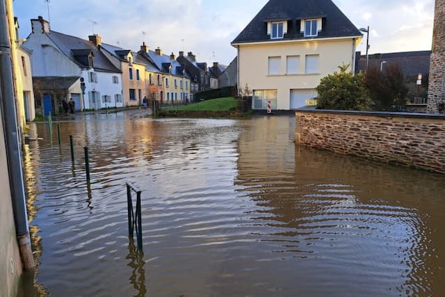
The rain will continue to fall over a large part of the country for the whole week… This Monday 26th January 2026, a new disruption will reach brittany with sometimes heavy rain on soils already waterlogged.
Some floods could still occur.
ALSO READ: Weather: flood risks in Brittany and the southwest, update on the situation
New disturbance in the west
“The disrupted sequence is likely to continue until the end of January, or even the beginning of February”, says meteorologist Yann Amice.
This Monday, it is therefore a new disturbance which will “reach the Breton peaks during the day”, the meteorologist tells us.
It is accompanied by sometimes sustained rain, contributing to increased accumulations on soils that are already heavily used.
These rains will be accompanied by gusts of the order of 70 to 80 km/h. What is worrying is that in Brittany, rivers have already overflowed in places and that Morbihan and Ille-et-Vilaine are placed on orange alert by Météo-france.
Finistère and Morbihan are also in an orange alert for rains and floods.
Rainy week
And if Monday is rainy, the rest of the week will not be left out. Tuesday, an “active trolling sky” will remain over Brittany, rain and wind will still be there. But the Alps and the south of the country are also expected to be affected by rain.
A depression will deepen over the Mediterranean, causing rain on the coasts of Var and Alpes-Maritimes. In the evening, the passage of the cold front will cause more snow low altitude on the first foothills of the Northern Alps, this snowfall will continue until Wednesday morning.
Depression dynamics which will continue this Wednesday, where Brittany will once again be scrutinized since rain should once again appear with sustained gusts.
“Problematic”
Thursday will feel like a “transition day”, although showers are still possible. A transition therefore towards… a new disruption.
The rains resume more sharply and the wind strengthens again, with gusts of up to 90 to 100 km/h.
And if it is difficult to push the forecasts beyond Friday, “the trend for the beginning of February remains frankly oriented towards the continuation of disturbed weather with a new disruption envisaged Monday February 2 carried by a vast system low pressure on the North Atlantic”, foresees Yann Amice.
Especially since the winter storm suffered by the United States in recent days will not help this dynamic. In this context, “the accumulation of precipitation will become problematic”, warns Yann Amice. On Brittany therefore, but also on the Alps and Corsica.
Enjoyed this? Get the week’s top France stories
One email every Sunday. Unsubscribe anytime.


