Thunderstorms, Rains, Floods, Strong Winds: Eleven departments of the South-East on Orange Alert

An intense Mediterranean episode continues in the south of France this Saturday 23rd November 2019.
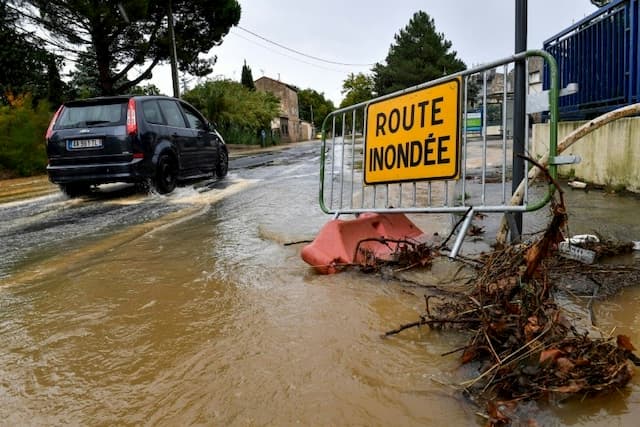
Météo France has placed 11 departments in orange alert for storms and rain-flooding and strong winds, anticipating an intense Mediterranean episode in the south of France for Saturday.
In its 6 o’clock bulletin, Meteo France judged that the current episode of intense rainfall required “a particular follow-up because of its intensity and duration” for the southernmost departments and that the episode of strong wind, in the departments further north, could “impact urbanized areas or weakened by the recent snowfall.”
🔶 11 dpts en #vigilanceOrange
Restez informés sur https://t.co/rJ24zzmmy4 pic.twitter.com/3v8DcytJiu
— VigiMétéoFrance (@VigiMeteoFrance) November 23, 2019
Up to 70 mm of rain
Météo France fears heavy rains and thunderstorms in the Ardèche, Gard, Hérault, Gard, Lozère, Alpes-Maritimes, Bouches-du-Rhône, and strong winds in the Drôme, Isère and the Loire. The Aveyron is concerned by a flood warning.
Friday night, Météo France was between 40 and 90 mm on the Cevennes, between 30 and 70 mm on the Var and the Alpes-Maritimes. Météo France forecasts that the intensities of the precipitation will strengthen in the night and Saturday morning with a stormy aspect more and more present. “Values of 30 to 40 mm in one hour will be possible between the morning and the beginning of Saturday afternoon near the Var and Alpes-Maritimes”.
En cours | #EpisodeMéditerranéen touchant notamment Cévennes et PACA jusque demain soir. Les fortes pluies s’accompagnent d’orages, de grêle et de fortes rafales (100 km/h)
Attention également au vent fort sur #Drôme, #Isère
et #Loire
Restez informés ▶️ https://t.co/rJ24zzmmy4 pic.twitter.com/7yclgMOcFl— VigiMétéoFrance (@VigiMeteoFrance) November 22, 2019
Floods
“The wind blows strongly on the Mediterranean coast,” adds Météo France, noting that storms circulating near the coast may be accompanied by hail and tornado-like whirling phenomena.
It is in the Var that the risk is greatest with accumulations expected between 120 and 150 mm, 180 to 250 mm locally. Friday night, Var firefighters intervened in Hyères for a mini-tornado that spilled several vehicles, including a truck, and caused damage in a commercial area.
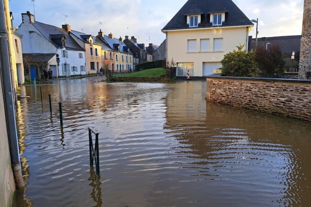
The rains on the south of the Massif Central as well as on the Paca region, “will generate significant floods”. Precipitation will be aggravated by a strong wind near the shoreline and in the mountains, giving “strong waves of the southeastern sector combined with high water levels”.
Le #Vidourle en crue ce matin à #Quissac dans le Gard où le pic de crue est attendu cet après-midi… Source : https://t.co/1FF9ZYunXF pic.twitter.com/f39o7UryJT
— La Chaîne Météo (@lachainemeteo) November 23, 2019
Winds
As for the wind, on Friday night, it has clearly strengthened in altitude on most of the massifs with peaks at 171 km / h on Mount Aigoual.
#TEMPÊTE : Rafales à près de 200 km/h enregistrées en haut du domaine skiable des Ménuires (73) au pic de la Masse, 171 km/h au Mont-Aigoual dans les Cévennes. La Provence et le Languedoc sont également touchés par des vents violents avec 100 km/h à Sète (34). pic.twitter.com/5PdL9KJsuM
— La Chaîne Météo (@lachainemeteo) November 23, 2019
In the coming hours, the wind from south to southeast will continue to blow very strongly, “even violently” and will be particularly on the heights of the Massif Central. Gusts over 100 km / h are also possible in the agglomeration of Saint-Etienne.
Météo France also forecasts a very strong mountain wind over the Vercors and the Inner Alps with gusts above 100 km / h at altitude. “These strong gusts can also affect the plain areas between the north of Drôme and Voironnais in Isère where the structures have already been weakened by the snowfall last week,” adds Météo France.
Enjoyed this? Get the week’s top France stories
One email every Sunday. Unsubscribe anytime.


