Weather. A Restless Friday: Rain, Strong Winds and Snow

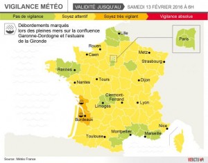
This Friday will be hectic, with rain, strong wind, snow. Charente-Maritime and Gironde are orange flood alert.
During the night of Thursday to Friday, a new active disturbance approached the west. It will bring substantial rain. Overflow will be feared in estuaries, particularly in Gironde at the sea of Friday morning.
This disturbance will rush quickly inland across all regions south of the Seine before midday. Rainfall sparing only the regions from North Picardy northeast.
Rains from the West
The rain will be from the west, will be followed by light snow in the plains of Normandy hills outside of the Ile-de-France, the Centre and Burgundy. In the afternoon, the disturbed time will extend to eastern regions.
Snowfall will shift to the Franche-Comté in early afternoon. Rainfall amounts will be quite significant on the west central and southern Aquitaine.

On the Massif Central, the snow level will evolve 400/500 m in early morning quickly 1 100/1 200 m by mid-day.
The Alps, she will announce in late morning from 500/600 m to quickly rise above 1 200 1 400 m.
The Pyrenees, the snow level will be high, often above 2000 m.
One more time then variable
After the highly rainy passage, a variable with cloudy and showers quickly install on the west.
The rain will not be too frequent when the rains will ease the northwest. On the Mediterranean, threatening time of the morning will bring a few small passages in rainy day.
The rains will become more sustained the afternoon of the French Riviera to Corsica with snow at medium altitude. This bad weather will be accompanied by strong gusts on the Atlantic coast, around 80 to 100 km/h with a strengthening southerly wind on the Lyonnais near 90 km/h top and a gusts strong enough in the afternoon extending through to the end of the day to Corsica with peaks at 80/90 km/h.
The morning frosts are rare and weak and only possible in the North-east or in the alpine valleys. In the afternoon, he will make 2-7 degrees to the north and North-east, 5-11 on the Northwest and centre of the country, 10-15 in the South west in the mild, 11-14 on the Mediterranean, 14-16 degrees in Corsica.
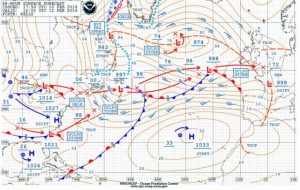
The weather map NOAA for this Friday noon:

Enjoyed this? Get the week’s top France stories
One email every Sunday. Unsubscribe anytime.


