Weather: A Gust of Wind will Hit the West Sunday Morning

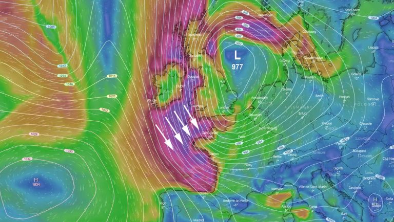
A strong depression will come to us from the North Atlantic this weekend. Centered on Ireland and Scotland on Saturday afternoon, it will shift to the North Sea on Sunday morning, generating northwesterly winds of 35 to 45 knots – with gusts at 100 km/h.
A dog’s blow. In other words, a season time. The anticyclone stationed on France and the British Islands for weeks having found a more usual place – over the Atlantic and not far from the Azores -, the depressions begin to classically continue their passages on our latitudes.
A depression coming from the American coasts will thus move towards the North of the British Islands from this Friday until Saturday at the end of the day (map below scheduled for Saturday 6pm).

Centered on Scotland and relatively hollow (981 hPa according to the American model GFS), it will generate reasonable west-southwest winds on the western facade of France.
During the night from Saturday to Sunday, however, a very disturbed time will invade a large northwestern half: the rains will sink to Poitou-Charentes, the Center and Champagne-Ardenne.

They will be relayed by locally stormy showers near the English Channel. The wind, especially, will become strong on all the coasts of the Channel and the Atlantic.
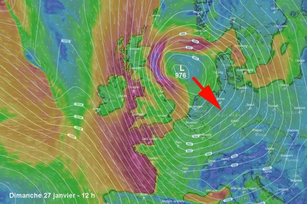
We expect 35 to 40 knots established in the morning of Sunday and until noon (map below) , with gusts of 50 to 60 knots – around 100 km/h.

A gust of wind, so, not a storm. But a sensitive phenomenon, on which models are pretty much in agreement.
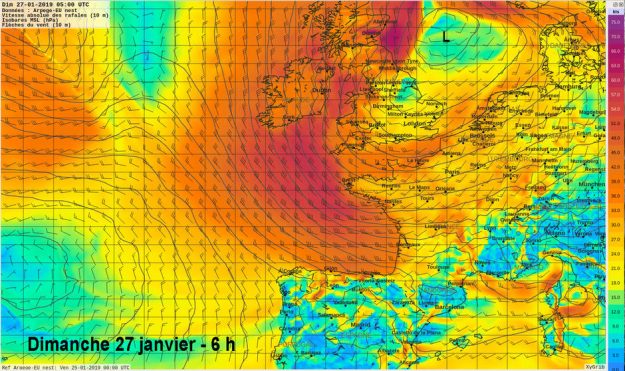
Rather, because the US GFS model is a bit more alarmist than the European model of ECMWF. As for the Arpège mesh of Météo France (map below) , it confirms very strong northwesterly winds over Brittany and the English Channel.

Sunday evening, the disturbance will evacuate towards the southeast, gaining the Netherlands and Denmark, generating a flow of noroît measured on our coasts.
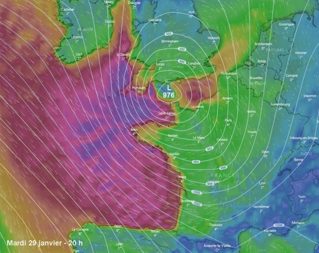
But do not rejoice too quickly: this Tuesday, January 29 (map below) , a small hollow depression could severely shake the west facade of our country.

Enjoyed this? Get the week’s top France stories
One email every Sunday. Unsubscribe anytime.


