Weather: After Christmas, Beware of Storms and Rain
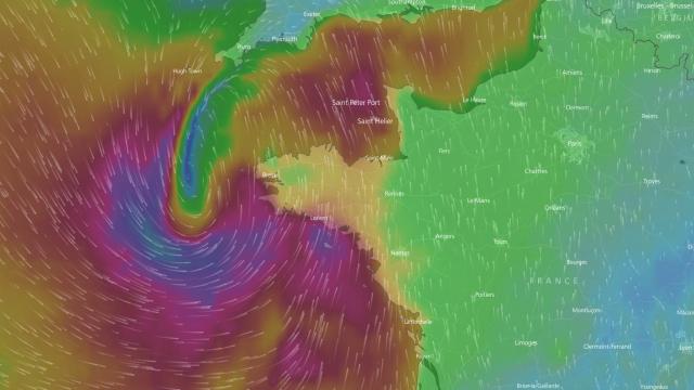
WEATHER FORECAST: From the 26th December until the end of the week, several disturbances, at least potentially violent, will come from the west, bringing strong winds and sustained rain.
Will there it snow for Christmas? If so, is that she has already fallen. Present for several days, a large high pressure system will continue to reign over France until Christmas, bringing gray and mild temperatures, at higher than normal cases. This winter break will be short: from the 26th until the end of the week, several disturbances, at least potentially violent, will come from the west, bringing strong winds and sustained rain.
Christmas on the balcony – for Easter, we’ll see … But it will enjoy. From Tuesday, December 26, until the end of the week, several changes will force us to stray by the fireplace. Not so much because it will be cold that because of three disturbances of varying intensity, which we will come to the Atlantic, sweeping Western country strong gusts and sustained rains sometimes.
Calm and gloom until Christmas
For now, and until Christmas Day, the weather will remain mild. Grey, but sweet. With a bit of drizzle, it’s true. The anticyclone does not prevent ocean water out of France, even blocking low clouds at ground level.
But no frosts, very little snow, no ice, and temperatures rather above the average: the minimum es vary between 3 and 9 degrees in general, with some frost in the Alpine valleys and inside Provence, while maximum level off between 7 and 12 degrees from east to west, 13 to 15 degrees near the Mediterranean.
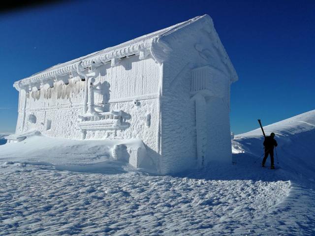
As noted that the snow is plentiful on the mountains:
Le point sur l’enneigement en montagne au 20 décembre 2017 : abondant dans la majorité des massifs ! ❄️❄️❄️ https://t.co/wemvEl2gZ6 #montagnes #neige (© Gilles Brunot) pic.twitter.com/qawR8mx6SC
— Météo-France (@meteofrance) 21 December 2017
Note that even when areas of low rainfall bypass the high, affecting mainly the North and East.
Until Monday 25th December, however, the southeast of the country will experience long sunny periods, although some are still possible freezing fog in the morning.
After Christmas, wind and rain
– From Tuesday 26th December, the weather will change dramatically with the arrival of a first disturbance came from the West. First, not very violent, it will widen and almost passed over the North-West of France, bringing south-southwest winds over much of the country.
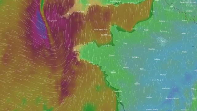
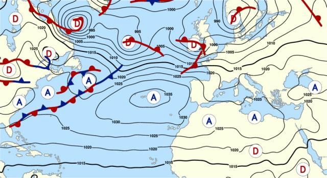
A risk gale in the night from Tuesday to Wednesday remains likely.
In the following days, and although it is a bit early to be assertive, time should not really calm down.
– Wednesday , depression being discharged into the North Sea will bring northwest winds sustained on the Cotentin and Brittany.
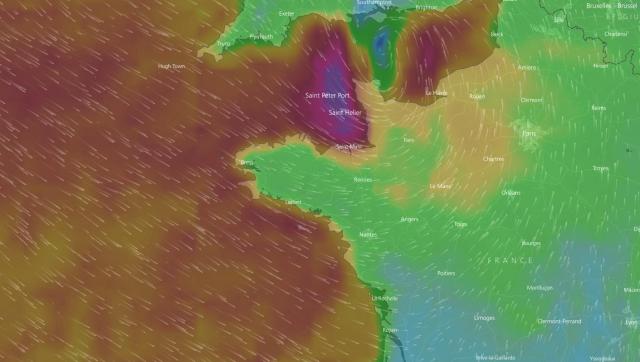
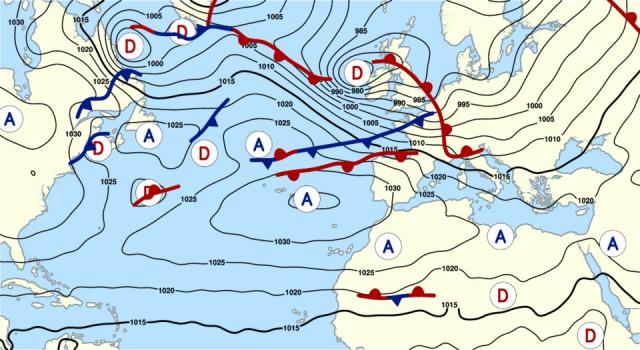
– Thursday , a second low pressure center should approach Britain from the west, with winds of southern established (illustration on top of the article). The Morbihan and Finistere coast will be exposed to higher gusts and waves, fortunately with low tide coefficients (we will neap).
After the passage of the depression, the wind should switch northwest remaining sustained.
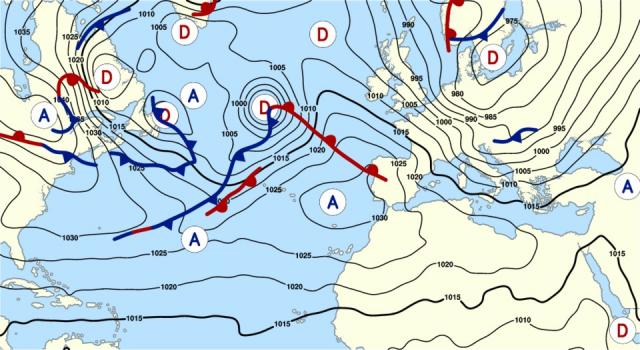
– Friday, another gust of wind, potentially safe, could affect much of the British Isles and the North West of France. This phenomenon, like the two that precede it, will be monitored closely.
The position of the minimum low pressure will obviously be decisive on the effects of the storm on our shores as possible: a few degrees of latitude in either direction can change many things.
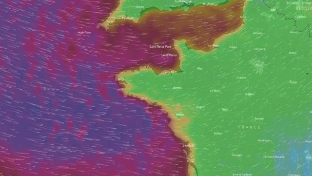
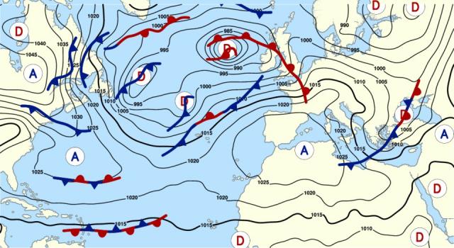
Anyway, in these school holidays, the call to caution remains more than ever, whether on the road or along the coast.
Dôme anticyclonique sur la France jusqu’à #Noël nous préservant des intempéries pour le #réveillon – Brusque dégradation à partir du 26 – Nous surveillerons alors le risque d’un creusement dépressionnaire à même la France : #vent fort, pluie et #neige en #montagne (@wxcharts) pic.twitter.com/KbIqpnaaCZ
— Météo Villes (@Meteovilles) 20 December 2017
Enjoyed this? Get the week’s top France stories
One email every Sunday. Unsubscribe anytime.


